Geodetic Engineer
Dempsey Resource Management Inc.
Keterangan Kerja
- Performs land surveys to establish boundaries, elevations and topographical features.
- Uses geodetic equipment including GPS to collect and analyze survey data.
- Conducts boundary surveys, land mapping and land title surveys to determine property boundaries and prepare legal documents.
- Gather, analyze and interpret geospatial data to produce accurate maps and reports.
- Utilizes software such as GIS, AutoCAD and other mapping tools to design and develop survey results.
- Utilizes software such as GIS, AutoCAD and other mapping tools to design and develop survey results.
- Ensures that all surveying work adheres to relevant industry standards, local regulations and quality control procedures.
- Troubleshoots and resolve discrepancies in survey data and provide solutions for project-related challenges.
- Graduate of Bachelor of Science in Geodetic Engineer
- Knowledgeable in Microsoft office applications such as Powerpoint and Autocad.
- Must be trustworthy, patient and flexible.
- Good in oral and written communication.
Maria Palma
Talent Acquisition ManagerDempsey Resource Management Inc.
Balas Hari Ini 0 Kali
Tempat Bertugas
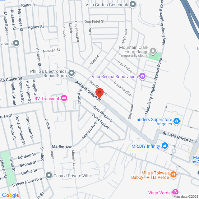
Pulung Maragul. Pulung Maragul, Angeles, Pampanga, Philippines

Disiarkan pada 05 September 2025
Pekerjaan Serupa
Lihat selanjutnyaGeodetic Engineer/PRC Holder/2 years in Land Mapping & Surveyor
 Dempsey Resource Management Inc.
RM1-1.7K[Bulanan]
Di lokasi - Angeles1 - 3 Tahun PengalamanSarjana MudaSepenuh-masa

HR Vilma DempseyTalent Acquisition Manager
Geodetic Engineer
 Likas Yaman Service Corporation
RM1.4-1.7K[Bulanan]
Di lokasi - Bulacan1 - 3 Tahun PengalamanSarjana MudaSepenuh-masa

nathan JonHR Officer
Geodetic Engineer
 Turfgrass Management, Inc.
RM1-1.4K[Bulanan]
Di lokasi - Pampanga<1 Thn PengalamanSarjana MudaSepenuh-masa

Jocelyn DiamanteHR and Admin Supervisor
Geodetic Engineer
 CHMI Land Inc.
RM1.4-2.8K[Bulanan]
Di lokasi - Bataan1 - 3 Tahun PengalamanSarjana MudaSepenuh-masa

Katelyn Joy MercadoHR Officer
Estimator / Project Coordinator / Tele-Sales Specialist
 Vogt's Hometown Roofing, LLC
Boleh Dirunding
Di lokasi - Angeles1 - 3 Tahun PengalamanSarjana MudaSepenuh-masa

John VogtCEO

Dempsey Resource Management Inc.
101-500 Pekerja
Sumber Manusia
Lihat pengambilan kerja
Sertai Bossjob
Peringatan Keselamatan Bossjob
Jika jawatan memerlukan anda bekerja di luar negara, sila berhati-hati dan berhati-hati dengan penipuan.
Jika anda menemui majikan yang mempunyai tindakan berikut semasa pencarian kerja anda, sila laporkan segera
- menahan ID anda,
- menghendaki anda memberikan jaminan atau mengumpulkan sesuatu,
- memaksa anda untuk melabur atau mengumpul dana,
- mengumpul faedah haram,
- atau situasi haram yang lain.
